Why Rivers Bend: Reading Meanders Through Erosion and Deposition
This article was translated from its source language with AI assistance. Please check technical terms and equations against the original.
A river's curve is not a fixed line
Maps often show rivers as sequences of bends, or meanders. Where the slope is gentle and a river can move the surrounding soil and sand, its channel may change position over time. The banks and bed change along with the route of the water. Rivers do not all develop the same pattern: bedrock, terrain, vegetation and structures can constrain the flow.
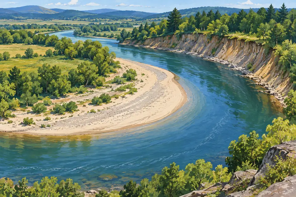
To understand a meander, watch sediment as well as water. Material can be removed from one part of a bend while accumulating elsewhere. This coexistence is the starting point. The USGS meander lesson describes outer-bank erosion and inner-bank deposition as basic features to look for.
The outside erodes while the inside accumulates sediment
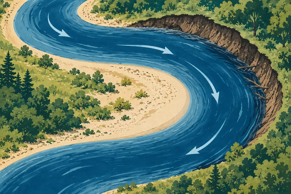
In a typical meander, stronger flow toward the outside tends to erode the bank. Relatively slower flow and sediment movement help sand or gravel accumulate on the inside. A steep outer bank and a gently sloping inner bar may therefore appear together. Actual flow is more complex than a simple arrow drawn on the surface: movement near the bed and through the depth matters too.
For example, a pale bar on the inside of a bend in an aerial image is a candidate deposition feature. The steep bank opposite it is a candidate erosion feature. Brightness alone cannot establish the material or rate of change, however. The amount of water and the date of the photograph affect which areas are submerged.
A cutoff can leave an old channel behind
If water takes a shorter new route as a bend develops, part of the old curve can become separated from the main channel. A lake left by this process is an oxbow lake. The USGS satellite-image explanation of oxbow lakes shows old bends alongside newer channels. These lakes are traces of where a river once flowed.
A large bend does not mean a cutoff is imminent. One map shows only a moment in a process. Separate observed features from predictions in your notes. Even after separation, sediment can enter an old bend and its connection to flowing water can change. Treating it as a permanently frozen ornament would miss this continuing history.
A small observation exercise with two maps
Select aerial images of the same reach from different years. Align landmarks such as bridges or major roads first. Mark the outer bank and inner bar in different colors, then compare movement and changes in the bar's shape. This produces more specific questions than simply observing that the river curves.
- Check whether the dates and water levels are comparable.
- Distinguish the edge of the water from the actual riverbank.
- Record levees or construction that might offer other explanations.
This is a map-reading exercise, not a direct measurement of yearly erosion or hazard. If evidence is limited, write that more of a bar is exposed rather than concluding that the bed has risen. Careful wording improves the quality of the observation.
Original illustrations created to help explain this article.